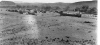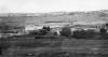
Traditional Agriculture in New Mexico: Planting With The Moon
Contributed by Michael Miller
Traditional Agriculture in New Mexico: Planting With the Moon
Contributed by Michael Miller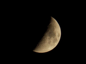
Traditional Agriculture in New Mexico: Planting With The Moon
Contributed by Michael Miller
A great story about one of our World War II Veterans, from the Santa Fe New Mexican. A W.W.II Veteran from Belen, did something He'd always wanted to do.
Graduate from High School. Luis Silva who landed at Omaha Beach on D-Day, always dreamt of getting his diploma. The 90 year old veteran recieved his
this week, 71 years after He was drafted - Officials say that He earned the credits to graduate before the war. After the war He returned home to Belen, got
married and raised 4 children. He proudly watched his children, grand-children, and great grand-children graduate. This week Mr. Silva and his great -grand
daughter graduated together. Everyone have a good and safe Memorial Day. Como Siempre, Ed Saiz
My Grandfather's Birthplace on the Santa Fe Plaza
Contributed by Arthur Scott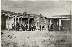
My Grandfather's Birthplace on the Santa Fe Plaza
by
Arthur Scott
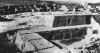
I recently discovered that my grandfather, Arthur Seligman, was born in 1881 on the Plaza in Santa Fe. According to Ralph Emerson Twitchell's "Old Santa Fe," published in 1925, Arthur was born to Bernard and Frances Seligman in the residence in the rear of the Siligman-Cllever (Seligman Brothers) store. Later this location was advertised as "The end of the Santa Fe Trail" As an infant Arthur made three trips with his mother over the trail. The view in the 1855 photograph is looking at the corner of present day San Francisco and Old Santa Fe Trail. This street has carried the names of "Santa Fe Trail, Seligman Street, Shelby Street, and Old Santa Fe Trail."
The store is shown above on the right in what William Stone (New Mexico Them and Nowe) calls the oldest photo found of Santa Fe. He also noted that Sigmund Seligman, my great uncle, was the first photographer in New Mexico. Before entering the mercantile business in 1852, he ran a daguerreotype portrait studio for a short time in Santa Fe. To the left is the Exchange Hotel, the only lodgings in Santa Fe at the time of the photo..
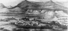
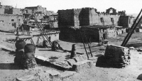
Walpi Snake Dance by Elita Wilson, former resident of Santa Fe?
Contributed by Jim Baca
Elita Wilson, a former resident of Santa captured this photo according to the inscription on the back of the photo. No known date.
Pueblo Land Grants in New Mexico: Research Sources
Contributed by Michael Miller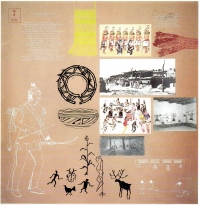
More...